The Staggering Power of Volcanoes
https://share.transistor.fm/s/c211fe71
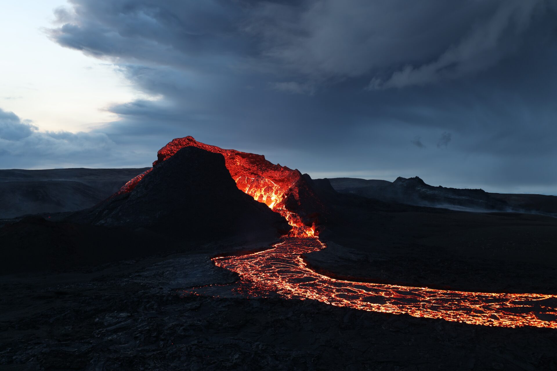
As people in Iceland brace for a volcanic eruption on the Reykjanes peninsula, we sat down to talk to two geologists, Dr Ria Mukherjee and Dr Nick Tailby about the geological processes behind these behemoths of nature. Located on the Mid-Atlantic Ridge and positioned over a divergent plate boundary and hot-spot, Iceland is one of the most volcanically active regions on Earth.
Ria explains that these ridges, such as the one that Iceland sits above, are spread across the globe and are responsible for forming the ocean crust. “The majority of our ocean crust is getting formed at the mid oceanic ridge. Iceland is one of those, and then you’ve got the hot spot, which is a constant pool of magma, or a constant supply of magma that keeps happening.”
Over the past few weeks, residents of the town of Grindavik have been experiencing thousands of earthquakes, and were evacuated on the 10th of November. Ria explains that earthquakes tend to precede volcanic eruptions due to the pressure build up deep within the earth. “Think about a viscous magma, which has a significant volume and mass, and it’s trying to have its way up to the surface, [and] make space for itself to erupt.”
“There’s a pressure that the magma has[…]not just it’s own pressure, but also fluids that are there in the magma that can start exsolving to form fluid pressure. All of that will try to overcome the surrounding pressure of the rust to break open fractures. The magma is trying to create openings and cracks for it to erupt, and that’s when you would have the earthquakes.”
It’s these earthquakes that help volcanologists and seismologists to monitor volcanic activity. Nick explains that there’s a wide variety of techniques that can be used to monitor volcanic activity. One of the main ones is seismic arrays. “You have these seismometers and they’re basically grids. So at a place like Iceland where you have rifting, you can monitor the arrival time of an earthquake, shockwaves. If you do that at enough locations, you can see the difference in the arrival times, and that provides you with some information about the 3D geometry of the magma chamber itself.”
“So for this reason, you can see the arrival times are changing, we can see that this magma is actually rising in the crust.”
Another method Nick discusses is the topography, or physical geography, of the volcanic edifice as well as the magmatic gases. Ria notes as well that measuring ground subsidence – or sinking of the ground – is another method used to monitor seismic and volcanic activity.
For those people interested in the geology and the eruption itself, Nick suggests heading to Google Earth. “You can actually see the rift just from satellite imaging, and it’s a series of what we call echelon veins. These are tears in the crust, and it’s really sort of the scars of tectonics.”
Scientists are still monitoring the situation intently, with many researchers believing that this could indicate that this region of Iceland is entering a new era of volcanic activity, one that could last for decades or even centuries.
Photo by Toby Elliott on Unsplash