Why is it so cold right now? And how long will it last? A climate scientist explains
Andrew King, The University of Melbourne
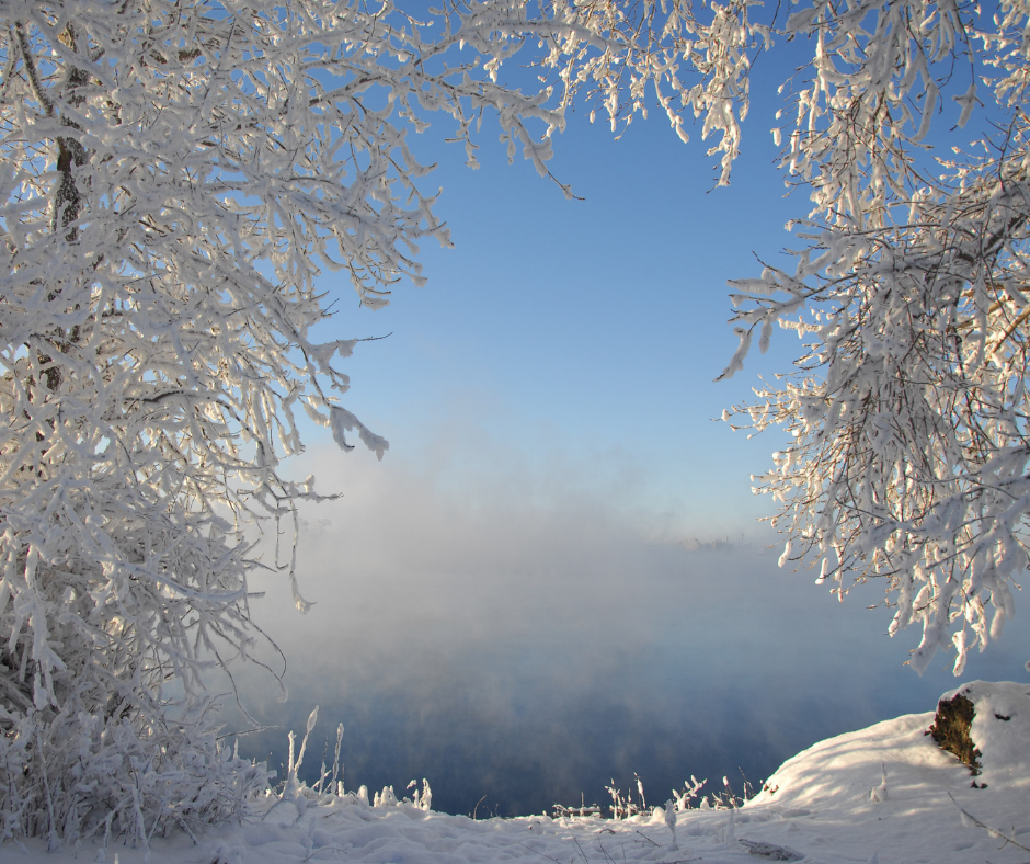
Anyone living in the southeast of Australia will have noticed the chill that has set in the last few days. After relatively mild conditions last week, an early blast of winter has arrived.
These temperatures are well below average, even for the middle of winter.
So why is it so cold? And how long is the chill going to last?
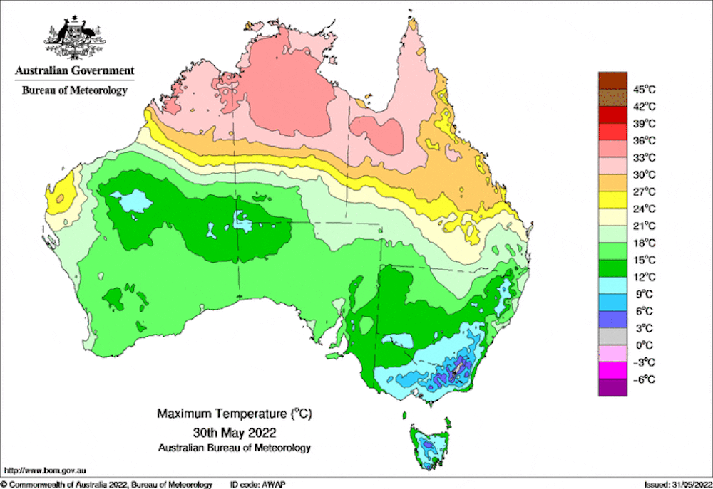
Bureau of Meteorology
An Antarctic blast
Much of southeastern Australia is currently under a cold air mass that has come from the south.
This is because a low pressure system that brought heavy rain, strong winds, and even a possible tornado to South Australia, has moved eastwards.
Air moves clockwise around low pressure systems in the Southern Hemisphere, so low pressure over Tasmania and the Tasman Sea means we have strong southerly and south-westerly winds over Victoria and New South Wales.
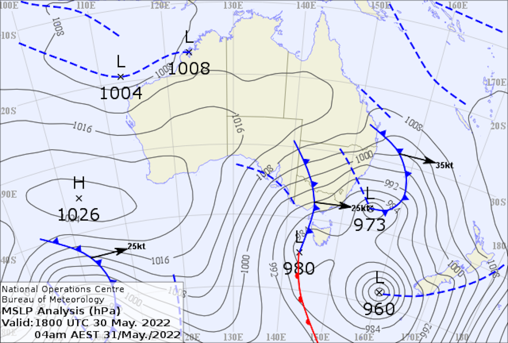
Bureau of Meteorology
As the low pressure moves east, cold fronts and troughs have crossed the region. This has led to most of southeast Australia experiencing rain or snow.
While a high pressure system briefly dominates our weather on Thursday, a new low brings cold and wet conditions again through the weekend. Another cold front is forecast to cross Tasmania, Victoria and southern New South Wales on Friday night.
How unusual is this?
For many Australians this cold snap will have been an unpleasant shock to the system. But it is not unusual to have cold spells bringing wet and windy conditions to Tasmania, Victoria and New South Wales.
However, this cold air outbreak has come quite early and has brought significant rain totals and persistent below-average temperatures.
For example, Melbourne is forecast to have nine days in a row where maximum temperatures are below long-term averages.
That includes five days where the daytime highs are more than 3℃ cooler than normal.

Author provided
Melbourne’s daytime temperatures are highly variable in summer – days over 30℃ as well as days where it doesn’t reach 20℃ are pretty common.
But at this time of year and throughout winter our daytime temperatures are much less variable.
The cold temperatures we’re seeing right now are only a few degrees below normal, but five days in this cold spell are in the bottom 10% of daytime temperatures we have seen at this time of year.
The cold weather is widespread across southeast Australia and is bringing significant early winter snowfall to some ski resorts.
Is this a sign for a cold winter to come?
Today is the first day of meteorological winter which covers June, July and August. With cold weather already here and forecast to persist over the coming days, does that mean we can expect a particularly cold winter?
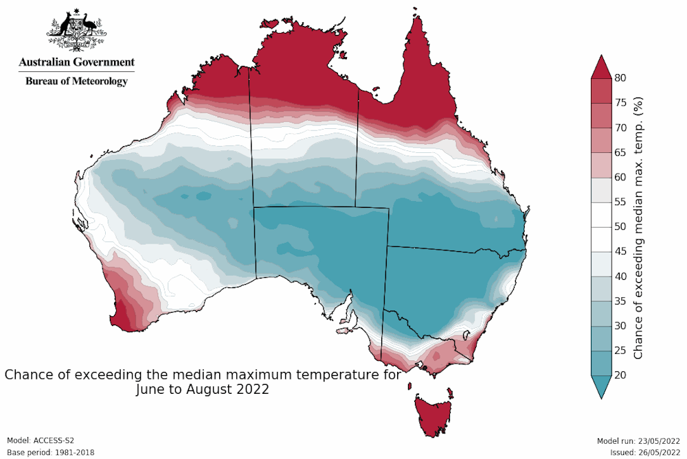
The Bureau of Meteorology’s seasonal outlook suggests cooler than normal conditions are likely over the interior of the continent.
This is remarkable since the average conditions the seasonal outlook is compared with are for 1981–2018. Over the last few decades Australia has warmed significantly making cooler than average conditions more unusual.
Bureau of Meteorology
The rainfall outlook is for widespread wetter-than-average conditions this winter.
This continues the pattern of rainy conditions we’ve seen in recent months which resulted in the devastating floods seen in February and March in southeast Queensland and coastal New South Wales especially.

Bureau of Meteorology
Australia’s climate is most strongly tied to conditions in the Pacific and Indian Oceans in winter and spring.
This increases skill in the Bureau of Meteorology’s seasonal outlooks compared with warmer times of year.
The cool and wet outlook is related to the persistent La Niña and the forecast development of a negative Indian Ocean Dipole (a natural climate phenomenon that influences rainfall patterns around the Indian Ocean).
Both of these phenomena are associated with warmer ocean temperatures near Australia, and are conducive to more moisture over the continent and stronger low pressure systems over southern Australia.
This in turn raises the probability of wetter than normal conditions and suppressed daytime temperatures.
Cold air outbreaks like we’re currently seeing over southeast Australia are a normal part of our cool season weather.
The outlook suggests we may see more of these cold spells than normal in winter 2022.![]()
Andrew King, Senior Lecturer in Climate Science, The University of Melbourne
This article is republished from The Conversation under a Creative Commons license. Read the original article.